
If you’re wondering whether it’s possible to see Kyrgyzstan in a week, the short answer is no – the country is vast. You could cover a lot by sticking to main roads, but you’d miss the real highlights: remote routes and scenic hikes. That’s where this Kyrgyzstan 1 week itinerary comes in. With a 4×4, reliable GPS tracks, a love for hiking, and a bit of luck with the weather, you can experience some of the country’s most breathtaking landscapes in just seven days.
Some fine print to start with
- 1 week = 7 full days, not counting arrival and departure day. For example, we landed very early in Bishkek, rested at a hotel, picked up our rental car in the afternoon, and only started the adventure the next morning, which counts as day one.
- Map.me app is essential for exploring Kyrgyzstan’s wilderness, since Google Maps doesn’t cover many of the most exciting Routes. I’ve explained this in my general post about Kyrgyzstan.
- Be flexible: Our original plan included the Routes around Issyk-Kul Lake and the Ala-Kul trek. The weather in Karakol wasn’t favorable, so we made a last-minute change that allowed us to discover other incredible places, including two amazing hikes.
DAY 1: BISHKEK – KONORCHEK CANYON (ROUTE 4)
Our first stop from Bishkek was Burana Tower, a “must-see” in every Kyrgyzstan guide. This ancient minaret from 11th century, stands as a reminder of the Silk Road era. The tower itself is nice, but the setting felt too commercial. If you’re interested in architecture and history, it’s worth the extra 1-hour detour from Tokmok.
Konorchek Canyon, on the other hand, is truly a sight for sore eyes. This is the first spot where you’ll need Maps.me, as there is no sign on the main road. Reaching the heart of the canyon takes about 60 minutes each way by 4WD on rocky roads. The hike into the canyon adds around 30 minutes each way, depending on your pace and photo stops. The trail is easy, with no elevation gain, and the canyon itself is absolutely breathtaking.
DAY 2: KOCHKOR – SONG KUL (ROUTE 16)
We spent the night in Kochkor before driving towards Song Kul Lake via Route 16. Without GPS tracks, we would have been lost again, but by then, we were already confident using them. The first stretch climbs through the winding Tuz Pass, with breathtaking scenery and numerous photo-stops along the way. At the top (3,228 m), there’s a perfect spot to stretch your legs and capture stunning 360° views of the colorful hills.
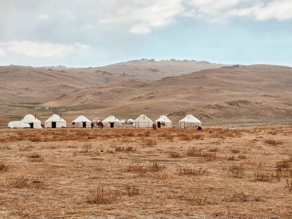
The drive down to the lake and along its shore was less impressive, though seeing yurts for the first time was nice. Many travelers choose to spend the night at Song Kul Lake in a yurt or tent, but we didn’t find it charming enough and continued to our next big stop – the Naryn region.
DAY 3: NARYN – RED HILLS (ROUTE 14)
Naryn town was a mess – the roads were all torn up for renovation, and we had trouble finding our guesthouse. Keep in mind that hardly anyone speaks English in Kyrgyzstan, so buy a SIM card (use code ANDA5890 for 3€ discount) and rely on translation. Anyway, for us, Naryn was just a stopover to spend the night and pick up our permit (covered in the main post) for the next day.
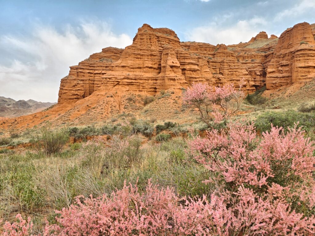
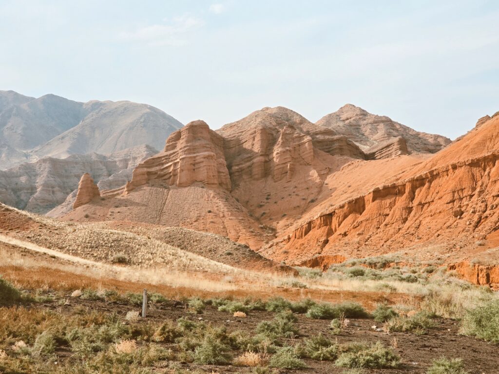
In the afternoon we drove the nearby Route 14 – the Red Hills of Kyrgyzstan. It was one of the shortest routes of our trip, but no short of beauty. With plenty of spontaneous photo stops and a good chance of being completely alone, it’s worth taking short hill walks for even better views – the scenery is stunning from above. And it’s not just red, it comes in all colors of nature!
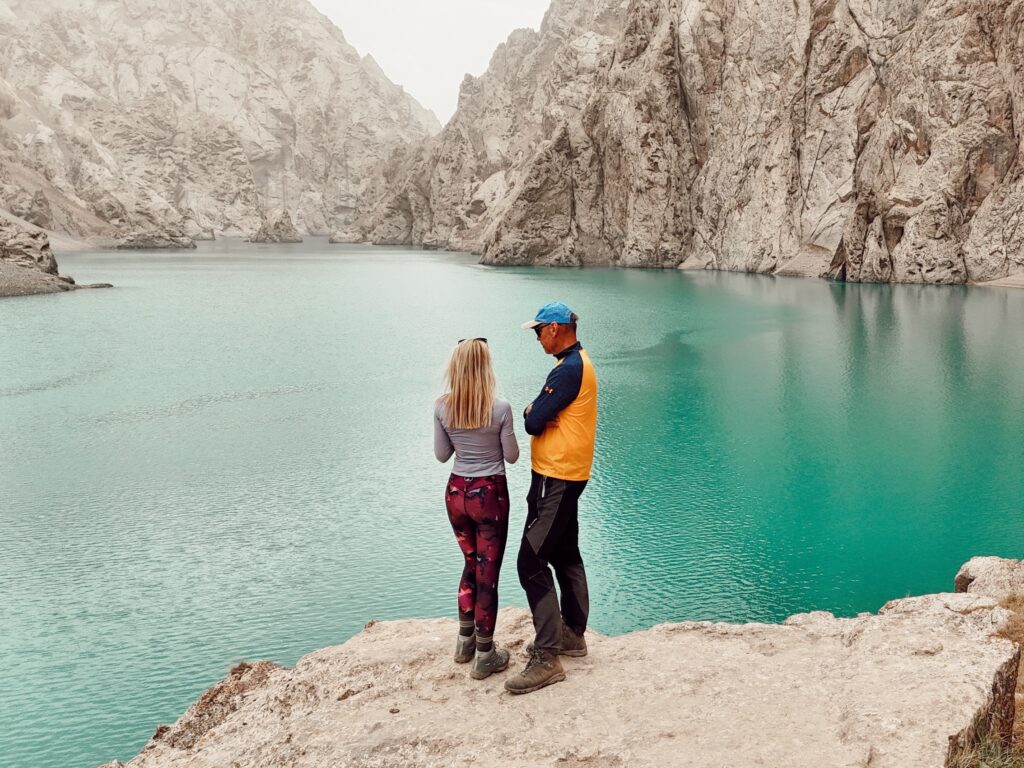
DAY 4: NARYN – KOL SUU LAKE (ROUTE 19)
Welcome to the highlight of our Kyrgyzstan adventure – my soul’s replacement for the Ala-Kul trek. Kol Suu Lake is a breathtaking gem, nestled high in the mountains at about 3,500 m. Luckily, the special permit and a long distance to get there keep the crowds away. The Kol Suu hike deserves a dedicated post, so I’ll describe it in detail separately – follow me on Instagram for updates and more travel inspiration.
We reached the starting point of the Kol Suu trek just in time for an easy afternoon hike. The 6 km hike one way rises about 300 m and is relatively easy. What makes it unforgettable isn’t just the emerald-blue lake, but the stunning trail leading to it. It’s one of the most scenic hikes I’ve done and I couldn’t stop taking photos every few steps. We spent the night at a nearby wild camping spot and it was the best (though the coldest) night of our journey.
DAY5: NARYN VALLEY
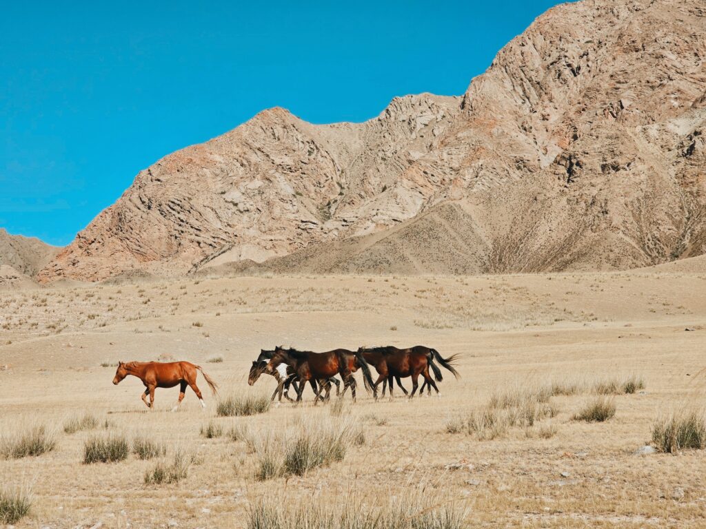
We took an easy morning to »defrost« from the cold night and witnessed some wild horses pass by our car. Unfortunately, we didn’t have enough fuel to take Route 18 toward the canyon in Kok Kiya Valley – a place we were eager to explore. Pro tip: bring a spare gas container, as there are no gas stations for miles away.
On the way back to Naryn, my boyfriend started showing signs of sickness – probably from some dried meat he had eaten the day before. We booked a lovely hotel in Tash Bashat, hoping he would recover. While he rested, I hiked a nearby hill in the company of friendly local dogs. The views of the Naryn Valley more than made up for our “missed” day. The landscape was absolutely stunning in every direction!
DAY 6: BACK TO SONG KUL (ROUTE 15)
We wanted to continue from Naryn Eri (Route 13) toward Arabel Pass, but the hotel owner warned us that a nearby bridge was broken, which would add a two-hour detour. So we decided to save Routes 6, 7, and 8 for another trip and headed to Song Kul Lake via 33 Parrots Pass instead. Compared to Route 16, this pass was even more impressive!
Crossing the colorful Parrot Pass is again a treat for all nature lovers. There’s a small waterfall on the way (the stop is marked) and at the top, you’ll want to stroll for the views. We skipped the road down toward Song Kul and returned the same way – still stunning but from a different perspective.
DAY 7: KOL TOR LAKE (ROUTE 1)
We spent the night in Tokmok (note to self: Trio Coffee serves a great cappuccino), before heading to the trailhead for Kol Tor Lake. This hike was also on my original Kyrgyzstan bucket list, and I was thrilled to do it under clear blue skies and summer-like temperatures. It’s not an easy hike, with 800 m of elevation gain in 6 km. I reached the top in just under 2 hours, while my boyfriend took a bit longer as he was still recovering from stomach issues.
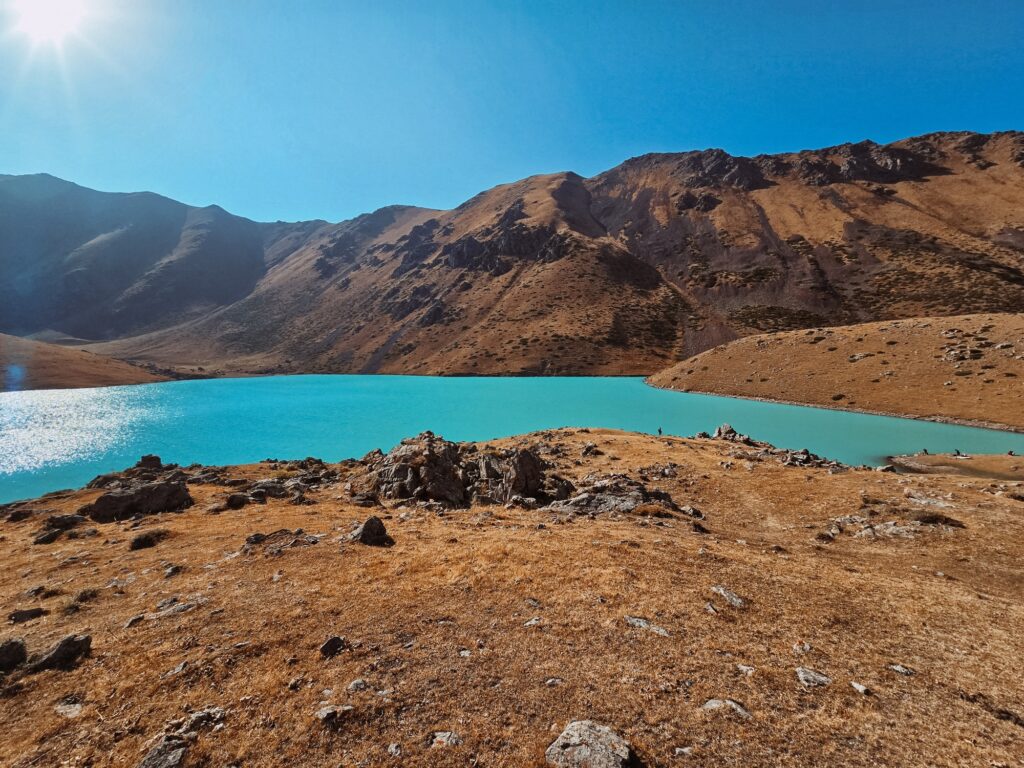
The lake is a stunning, eye-popping ice blue, and photos don’t do it justice. We hiked all the way to the spot where the glacier water flows in, and we had the place completely to ourselves. I wish all destinations were like this—where you can enjoy peace under the sun, like something straight out of a fairytale.
After that, we drove back to Bishkek, returned the car, and took our flight home late at night.
We’ve come to the end of our brief Kyrgyzstan 1-week itinerary. We could have packed in two more routes if my boyfriend hadn’t been sick, but that would have turned it into a road trip on steroids. Even at this pace, I missed moments to simply be bored and wander without a signal – but we’ve saved that for next time. On our return to Kyrgyzstan, we’ll tackle the Ala Kul Pass and explore the routes around Issyk Kul Lake. Yep, already planning another 7-day Kyrgyzstan adventure.